Khaosok History
- Home
- Khaosok History

20
Years
of experience


20
Years
of experience
Natural history of Khaosok
345-280 million years ago (Carboniferous)
Khaosok has a complex but fascinating geological history. During the Carboniferous Period , pebbly mudstones and sandstones of Kaeng Krachan Formation were deposited on the edge of a deep ocean basin. As sediments were washed down from the ancient landmass of Shan-Thai, They accumulated around a delta system (similar to that seen in the Mississippi delta today). These sediments built up into unstable deposits that periodically avalanched down the basin edge. Over the millions of the years of the Carboniferous, the basin was filled with sediment as Shan-Thai landmass was heavily eroded. This caused the sea to be shallower and warmer, conditions which allowed for corals and other organisms to thrive.
280-225 million years ago (Permian)
It was during this period that the permian limestone was deposited. Fossil remains found in the rock suggest a warm quiet sea and a coral reef (five times longer than the Great Barrier Reef) which stretched from China to Borneo.
In time this marine ecosystem became deeply buried under new sediment which created immense pressure resulting in the limestone rock we see here today.
136-66 million years ago (Cretaceous)
Carboniferous/permian sediment becomes buried to great depths by the weight of younger sediments on top becoming compacted and cemented by pressure. granite magma intrudes into sedimentary rocks causing baking of the immediately surrounding rock and associated tin-tungsten mineralisation
66-3 million years ago (Tertiary)
As the indian plate crashes into the asian plate sediments folded, faulted and up lifted. with the formation of the himalayas the whole of Southeast Asia is rotated clockwise. Limestone of the Ratburi formation become exposed to heavy erosion.
Present day
Erosion of much of the Ratburi limestone has exposed both the carboniferous Kaeng Krachan sandstone and siltstones as well as the cretaceous granite in South Thailand. remnant limestone forms the dramatic towering crags known as karsts which are still in the process of erosion by monsoon rains and pounding seas today.
Khaosok’s human history
The Khaosok area was, in all likelihood, home to nomadic forest dwelling tribes similar to the Mani (the last bands of hunter-gatherer forest peoples still surviving in the Trang mountains and near the boarder of Thailand and Malaysia, At the oldest know human habitation site in South East Asia, The Niah Caves in northern Borneo, archeologists have dated human skills back 37,000 years and found evidence of 50,000 year old habitation. The similarity of extensive cave systems and rich rainforest, and the fact that Khaosok and Borneo were connected by a land bridge during the last great ice Age make prehistoric occupation of this area more than more conjecture.
The 18th century
Burmese attacked the coastal towns of Takuapa, Takua Toong an Talang (Phuket) the survivors fled inland through the vast forest, crossing rivers and mountain, in fear of their lives. One group made their way as far as Khaosok
In 1944’s
A deadly epidemic struck the Khaosok settlement and ravaged the population. the few survivors once again fled for their lives. The abandoned village became know as Ban Sop, village of the Dead.
In 1961’s
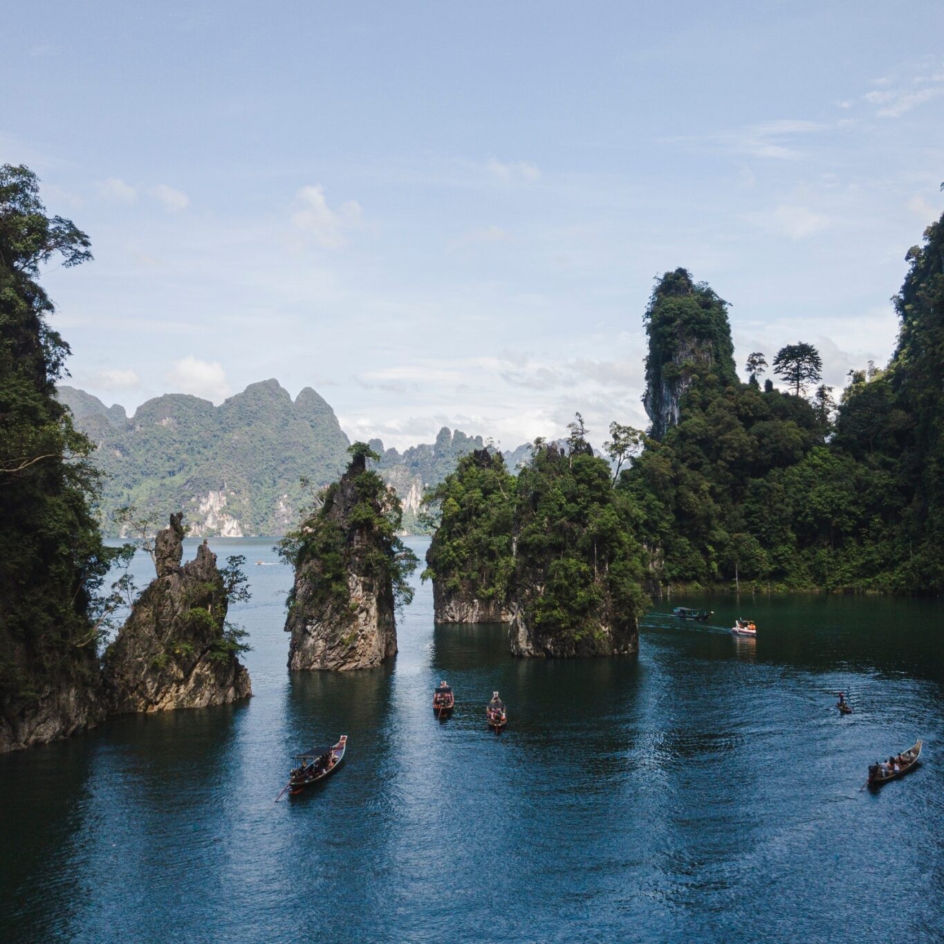
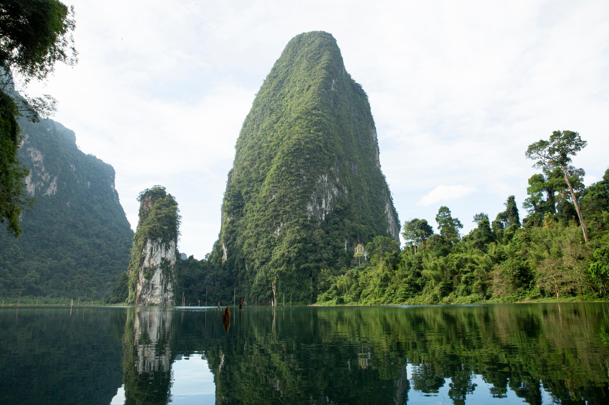
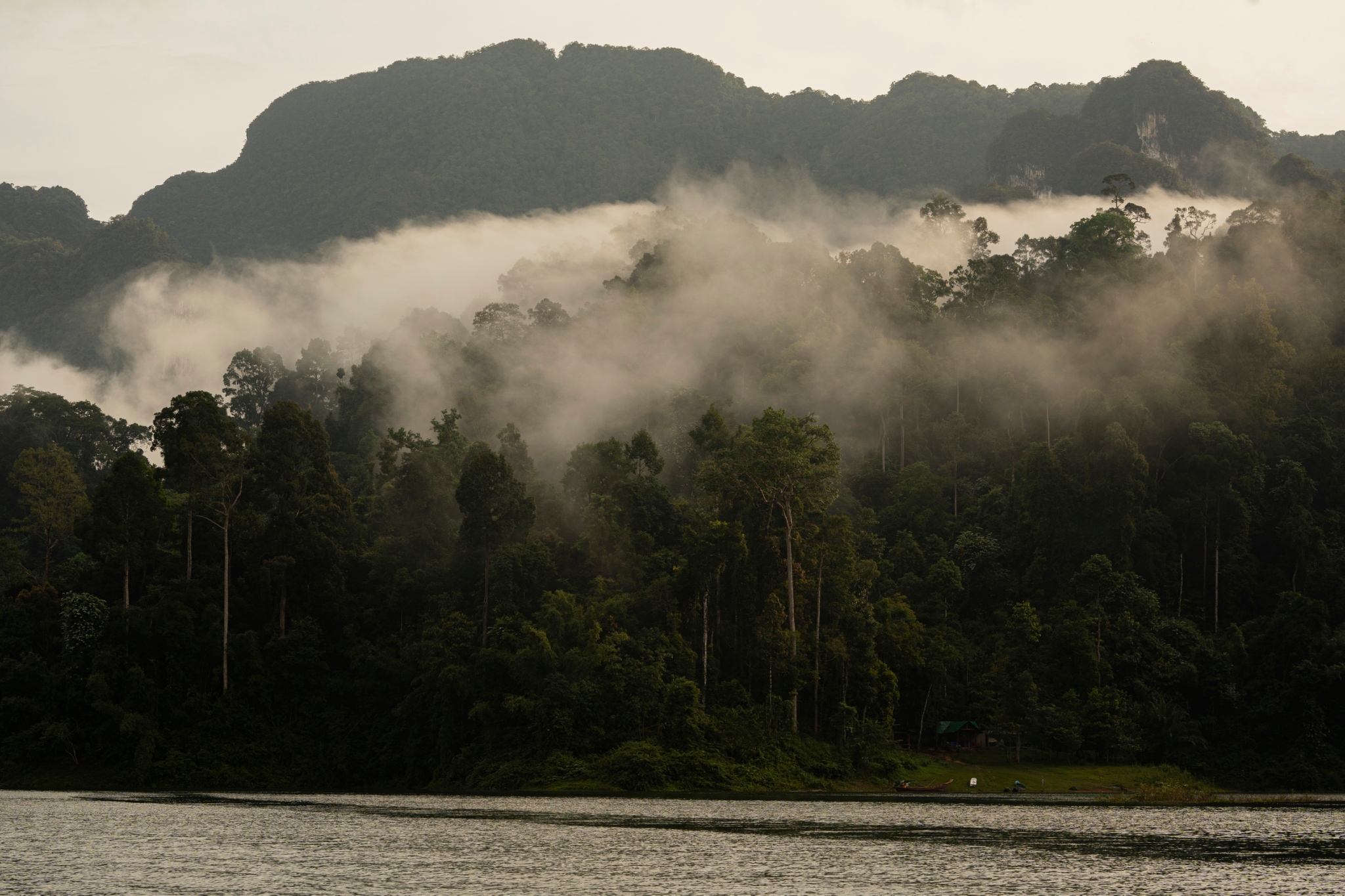
The village of Ban Sop remained isolated from the outside world, cut off by dense forest, until Mahat Thai company cut the road connecting Phun Phin in Suratthani province with Takuapa in Phangna province. About 1000 workers were brought in to build the road and they located their construction camp near Pantoorat Mountain. the old village of Ban Sok had new life. the new road brought a flood of eger settlers from the provinces of Songkhla, Nakorn Sri Thammarat, Chumpon, and Prachuab Khiri Khan who began to cut, clear and claim the richest wildlife habitat, the lowland forest, as their own.
In 1970’s
Many Thai students frustrated with attempts to bring about meaningful change in their government joined communist insurgency groups and fled into some of the last remnants of Thailand’s forest. Khaosok offered the perfect hideout. Between 1975 and 1982 these students not only kept the Thai Army at bay, their gold was defends rather than conservation but their seven years period of occupation was crucial to Khaosok’ protection. Also during this period the government took a look at the Khaosok region for other military reasons. An aerial survey in 1971 had already show that the mountain streams around Khaosok are part of the largest watershed in southern Thailand, and that the forest was still largely intact. Both the national park division and EGAT (the electricity generating Aothority of Thailand) now took a keen interest.
On the 22nd of December 1980
The Khaosok as a national park was begun.covering 645.52 sq.km. The Park Division marked out the boundaries of the park south from the Pasaeng and Yee river
In 1982’s
EGAT forever altered the park’s boundaries with the daming and flooding of the Pasaeng River. Ratchaprapa Dam, 95 m high and 700 m long, was constructed of shale and clay across the Pasaeng River in 1982 to create a massive 165 sq.km. reservoir to generate hydroelectric power. As the lake waters slowly rose EGAT funded the largest wildlife rescue operation ever undertaken in south Thailand. It was led by Serb Nakhasathien, who later took his own life to bring attention to the plight of the Kingdom’s wildlife.